
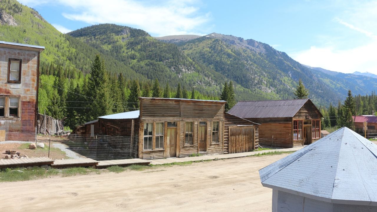
6 Colorado Ghost Towns Coloradans Drive Past Without Looking

A driver on Highway 82 between Glenwood Springs and Carbondale glances at a row of stone humps in the hillside and takes them for an old rock pile.
They’re not rocks. They’re ghost towns.
These are the Colorado ghost towns Coloradans drive past without looking.
Gilman
Thousands of commuters curve past Gilman every week on U.S. Highway 24, high above the Eagle River between Vail and Leadville.
Almost nobody slows down.
The apartment blocks and mine buildings still look livable, and until 1984 they were, when the Eagle Mine’s final closure emptied the town for good.
Empire Zinc Company had consolidated the surrounding claims into one operation by 1912, and an underground mill went up in 1929 to process the ore.
None of that shows up from the road.
What shows up is a fenced hillside the Environmental Protection Agency placed on the National Priorities List in 1986.
Mine waste had contaminated the groundwater running down toward the Eagle River.
Gilman sits on private property today, and the cleanup plan keeps it that way.
Federal and state regulators still have to approve any new use of the land.
Dearfield
The ghost town of Dearfield stretches along U.S. Highway 34, about 11 miles west of Wiggins, on the flat farm country between Greeley and Fort Morgan.
Farm trucks and commuters run that stretch every day.
Almost nobody driving it knows an entire town once farmed those same fields.
Oliver Toussaint Jackson founded Dearfield on May 5, 1910, as a homestead colony for Black families seeking to farm dry Weld County land as landowners.
It worked, for a while.
By 1921 Dearfield had grown to roughly 700 residents, a school, two churches, and farmland valued at $750,000.
Then the crop prices that built the town collapsed after World War I, and the Dust Bowl years finished the job.
Only 12 people remained by 1940.
Jackson ran a filling station and lunch counter along the highway until he fell ill in 1946, and he died two years later.
His niece, Jenny, stayed on alone until her death in 1973.
Some of Dearfield’s original buildings, along with a couple of ruins, still stand.
The Black American West Museum bought the core townsite in 2020 to keep a housing developer from building over it.
The museum runs organized cleanup and history days there, but Dearfield isn’t a regular stop with posted visiting hours.
A driver only sees it from the highway shoulder.
Wall Street
Wall Street sits along Fourmile Canyon Drive, the paved road Boulder County residents use every day to reach the mountain communities of Salina, Sunset, and Ward.
Drivers pass a two-story stone building with brick upper walls without knowing it once anchored an entire town.
That building is the Wall Street Assay Office, built around 1901 during a mining promoter’s push to turn the gulch into a mill town.
The push didn’t last.
A mill that cost $150,000 to build went bankrupt within a decade and was later torn apart for its lumber and metal.
The Assay Office is the one structure from that era still standing, and it earned a spot on the National Register of Historic Places in 1989.
Boulder County now owns and runs it as a small seasonal museum, open to the public on the third Saturday of the month from May through October.
The rest of the original town is now private mountain homes.
Outside museum hours, the Assay Office is easy to mistake for just another cabin along the canyon road.
Garo
Colorado Highway 9 curves past Garo’s old ranch buildings between Fairplay and Hartsel, and many drivers take them for a working spread.
They’re the last of Garo.
French immigrants Adolphe and Marie Guiraud homesteaded the site in 1862.
After Adolphe’s death, Marie grew the ranch to 5,000 acres and platted a town on the property.
She named it Garo, an anglicized version of the family name Guiraud.
A post office followed, then a store and a blacksmith shop.
The ranch outlasted the town.
The City of Aurora bought the property in 1985 to secure water rights.
The ranch already carried the Buffalo Peaks Ranch name by then.
Buffalo Peaks Ranch still leases the surrounding pasture to local cattle ranchers today.
The 1906 main house, a bunkhouse, a barn, and several corrals still stand right along the highway, on land the city owns outright.
None of it is open to the public.
What a driver sees instead is a fenced ranch gate and a row of buildings that could pass for any other South Park spread.
Psst! How much do you know about Colorado’s mining boom and the ghost towns it left behind? Take our quiz and see how many you can get right.
Quiz
Colorado Ghost Town IQ
Answer these questions on Colorado’s mining boom and the ghost towns it left behind. We bet you can’t get them all right. Prove us wrong?
Baby Doe Tabor, widow of Colorado silver king Horace Tabor, spent her final years alone in a caretaker’s cabin at a played-out Leadville mine, still hoping it would make her rich again. In what year was she found frozen there?
Cardiff
Cardiff's coke ovens line Highway 82 south of Glenwood Springs, the road tens of thousands of Roaring Fork Valley commuters drive between Glenwood Springs and Carbondale every week.
Workers built hundreds of the beehive-shaped ovens around 1888 to bake coal into coke for Colorado's steel mills.
Not all of them survived.
The company that ran them named the settlement Cardiff, after its coke was said to rank second only to coke made in Cardiff, Wales.
About 50 of the ovens still stand, and they earned a spot on the National Register of Historic Places in 1996.
Weather and time have worn them down, and Garfield County recently put $140,000 toward restoring them and adding accessible paths and historical signage.
The Glenwood Springs Historical Society, formerly known as the Frontier Historical Society, purchased the remaining ovens in 2017 and now owns nearly all of them.
Other stretches of the old Cardiff townsite remain private industrial land, so the ovens are still the one piece of the ghost town the public can see up close.
Ironton
Ironton's ghost-town remains stand about 150 yards off U.S. Highway 550, the Million Dollar Highway, roughly 8 miles south of Ouray.
Delivery trucks and daily commuters run that stretch year-round because it's the only paved route between Ouray and Silverton.
A sign marks the spot.
Only a few cars ever pull over.
The town started in January 1883 as Copper Glen and was renamed Ironton within months, growing to 323 residents by 1890 on silver money.
Then Congress repealed the Sherman Silver Purchase Act in 1893, and the price crash that followed shut down mines up and down the state.
A short gold revival in 1898 bought Ironton a few more years, but the population had fallen to 48 by 1910.
The post office closed in 1920, the railroad stopped running in 1921, and the town's last resident, Milton Larson, died in the mid-1960s.
About a dozen buildings remain, including a circa-1891 house with bay windows the Ouray County Historical Society works to keep standing.
Ownership across the old townsite is a mix of private and public land today.
The safest way to see Ironton is from the pullout the highway sign marks, not by walking up to buildings too fragile to bear a visitor's weight.
Why a Colorado Ghost Town Can Still Be Private Land
Colorado's mining-era ghost towns often sit inside land that looks open, ringed by national forest or public grassland.
Many of the actual townsites aren't open at all.
A prospector who "patented" a mining claim between the 1870s and the early 1900s bought that surface land outright from the federal government.
That private title never expired just because the mine closed decades later.
That's the reason a town like Gilman can carry "No Trespassing" signs today in the middle of what looks like empty wilderness.
Colorado's Ghost Town Count
Colorado carries more than 700 ghost towns, according to a decades-old count that traces back to a 1959 survey of the state.
That's not a rounding error.
Colorado has only about 270 incorporated towns and cities today, so the ghost towns outnumber the living ones by more than two to one.
Most of those 700 sit miles from any paved road, reachable only on foot, by four-wheel drive, or not left standing at all anymore.
9 Colorado Foods and Drinks That Confuse Every Out-of-Stater

A newcomer scans a Colorado bar menu, points at "Rocky Mountain oysters," and orders without asking a single follow-up question.
The dish that arrives next explains why the server watches that table a little longer than usual.
9 Colorado Foods and Drinks That Confuse Every Out-of-Stater
10 Things Coloradans Are Told About Their State That Aren't True
A hiker inside Rocky Mountain National Park points at a distant summit and calls it the tallest peak in Colorado.
It isn't, and the answer trips up many people who've lived in the state for years.
10 Things Coloradans Are Told About Their State That Aren't True
