
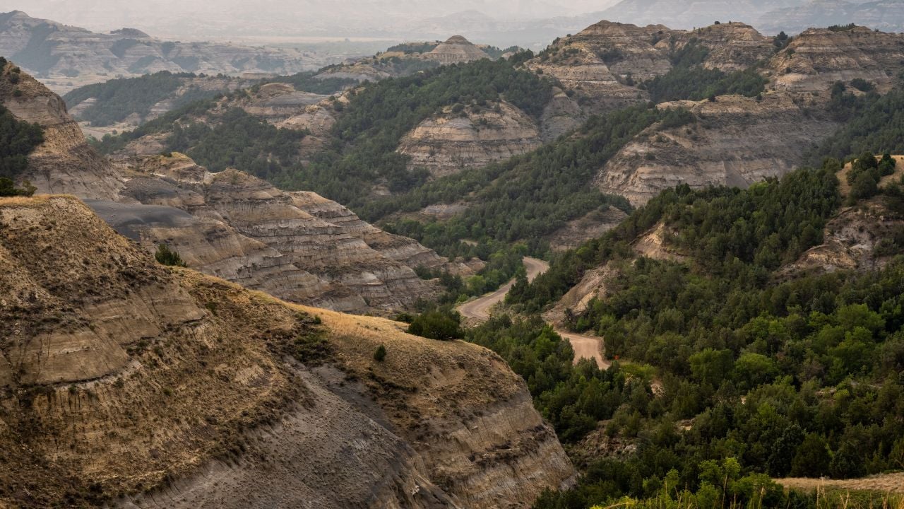
5 North Dakota Drives That Look Like Nothing Until You Stop

North Dakota’s population reached 799,358 people as of July 2025, an all-time high for the state.
Even so, much of the state is seemingly empty.
Long stretches of two-lane highway connect the state’s towns, and a driver can cover fifty miles without a single reason to slow down.
These are the North Dakota drives that look like nothing until you stop.
1. Elkhorn Ranch Unit
Elkhorn Ranch Unit sits between the North and South Units of Theodore Roosevelt National Park, and a driver gets no warning before reaching it.
Getting there means driving through Watford City and onto Forest Highway 2, roughly 90 minutes each way, mostly on gravel.
The unit isn’t reachable from a paved highway at all.
It sits roughly 35 miles north of Medora, tucked between the park’s North and South Units along the Little Missouri River.
A driver who loses count of the turns and the cattle guards could wonder if the road goes anywhere.
It goes to an empty pasture.
Roosevelt built Elkhorn Ranch in 1884, months after his wife and his mother died on the same day.
He later wrote about the cool river breeze and the buttes he could see from the porch.
The cabin is long gone.
What’s left is a grassy clearing lined with cottonwoods, a small parking area, and a row of stone foundation blocks marking exactly where the walls once stood.
Nothing else.
2. Crow Flies High Overlook
North Dakota Highway 23 runs west out of New Town and into Mountrail County, passing Crow Flies High Overlook along the drive.
The highway looks like any other two-lane road until the pavement gives way to a small gravel lot.
There’s no gate.
No fee, either.
North Dakota Parks and Recreation allows no camping or overnight parking at the overlook and keeps no restrooms or other facilities on site.
Walk to the edge, and Lake Sakakawea opens up below, along with the long span of the Four Bears Bridge.
The lake runs 178 miles and is the third-largest man-made lake in the United States, built when the U.S. Army Corps of Engineers finished Garrison Dam in 1953.
What the lake covers is harder to spot.
During low water, the old foundations of the town of Sanish break the surface.
Sanish moved to higher ground before the reservoir filled in behind the dam, and whatever didn’t move stayed exactly where it stood.
3. Writing Rock State Historic Site
A rural drive near Grenora, in the far northwestern corner of the state, leads to Writing Rock State Historic Site.
The small shelter building at the pull-off looks like nothing from the road.
Two granite boulders sit behind iron bars.
Nothing fancy.
Plains Indian peoples pecked and ground the designs into the stone long before anyone kept a written record of when.
The larger boulder stands just over four feet high, carrying a massive flying bird surrounded by interconnected lines and circles.
The smaller boulder carries a second, smaller bird connected to more circles, plus a third bird missing its head.
The smaller boulder once spent years away from the site, held at the University of North Dakota, before it was returned.
Admission is free, donations welcome, and there’s a picnic table if you want to stay a while.
4. Double Ditch Indian Village
The drive up Highway 1804 runs seven and a half miles north out of Bismarck to Double Ditch Indian Village.
The bluff above the Missouri River looks like ordinary grassland from the road.
Slow down anyway.
A gravel pull-off leads to a walking path across a field marked by shallow, grass-covered depressions.
Those depressions are what’s left of a Mandan earthlodge village that stood there from about 1490 to 1785.
It was one of seven to nine such villages that lined the Missouri near the Heart River at the same time, home together to more than 10,000 people.
The double set of fortification ditches that gave the site its name still shows in the ground.
No reconstructed lodges, and no gift shop.
Interpretive signs mark the walking path, and admission is free every day of the year.
5. Standing Rock State Historic Site
Standing Rock State Historic Site sits on a steep hill in North Dakota’s Ransom County, about two miles east of Little Yellowstone Park.
No signs from the road.
The state historical society warns that road conditions can get bad enough to affect access.
Drive up anyway on a clear day.
Four burial mounds sit at the top, three cone-shaped and one long and low, built as cemeteries by prehistoric peoples sometime between 100 B.C. and A.D. 600.
A boulder sits on top of the largest mound. Explorer Joseph Nicollet’s 1843 map named the whole site after that boulder, calling it Inyan Bosndata, the Santee Sioux name for the stone.
Nicollet had camped near it with John C. Frémont four years earlier, in 1839.
Today the hilltop has nothing more than a gravel lot and a single monument.
Psst! How much do you know about North Dakota’s geography and landmarks? Take our quiz and see if you can ace it.
Quiz
North Dakota IQ
Answer these questions on North Dakota’s landmarks and history. We bet you can’t get them all right. Prove us wrong?
Near Cooperstown, a former Cold War site called Oscar-Zero lets visitors ride an elevator underground. What was Oscar-Zero’s job before it became a historic site?
By the Numbers
North Dakota's population reached 799,358 people as of July 2025, an all-time high, according to Census Bureau estimates cited by the governor's office.
The state's land covers nearly 69,000 square miles.
North Dakota has added about 20,264 people since the 2020 census, a growth pace the state ranks 14th-fastest in the country.
Divide one figure by the other, and North Dakota holds fewer than 12 people for every square mile, one of the lowest rates in the country.
McKenzie County, out west, is the state's largest county by area, and Eddy County, out east, is the smallest.
8 Yosemite Mistakes Tourists Make Once Summer Ends
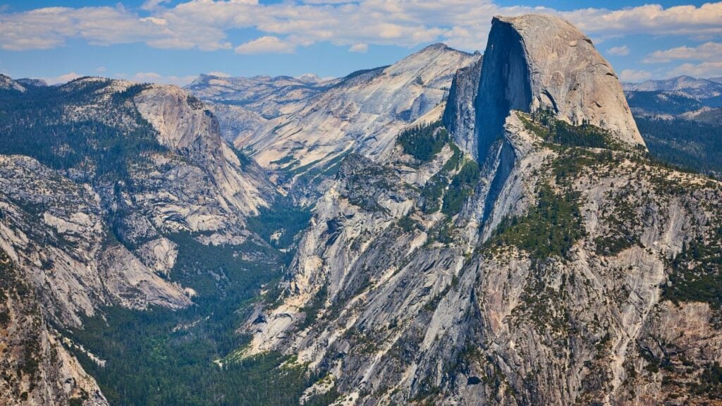
Labor Day clears out Yosemite's parking lots fast, and the park's calendar moves just as quickly behind it.
Shuttles stop running, campground reservation windows close for the season, and more than one visitor has shown up expecting summer rules to still apply.
