
5 Rhode Island Trails That End Somewhere Visitors Don’t Expect

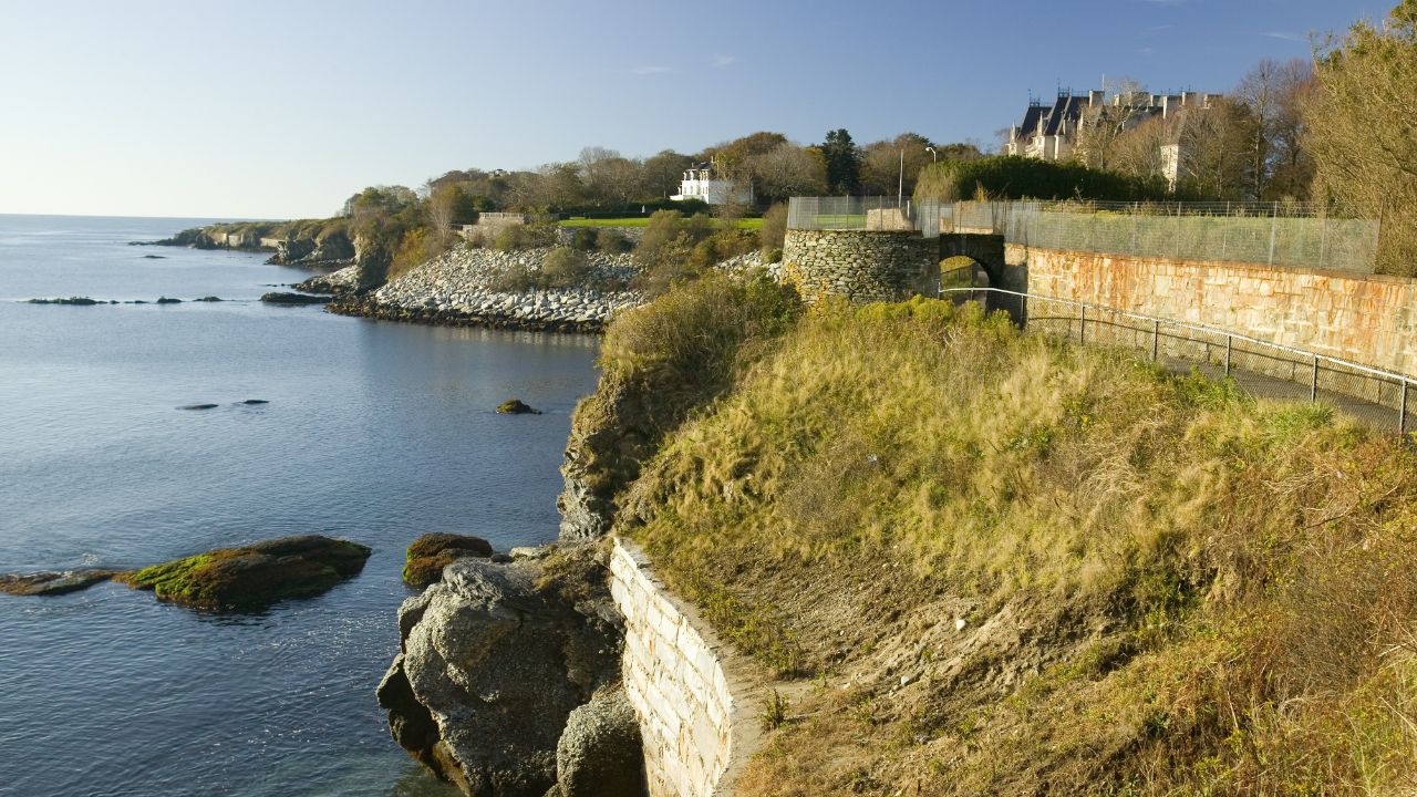
The Cliff Walk in Newport promises million-dollar views.
But it delivers a private beach fence instead.
These are the Rhode Island trails that end somewhere visitors don’t expect.
1. Cliff Walk
Rhode Island’s Cliff Walk in Newport starts as a paved, mansion-lined promenade and turns into a very different trail by its far end.
The walk runs about 3.5 miles along the bluffs, and its first stretch past the Gilded Age mansions is smooth, wide and crowded with tourists.
Public access along this shoreline traces back to a 1663 charter, when King Charles II promised Rhode Island’s colonists the right to fish and pass along the coast, a right the state constitution still protects today.
The pavement doesn’t last.
Past the mansions, the trail narrows into a rock scramble along the cliff edge, and hikers who started out in sandals tend to regret it by the final stretch.
That final stretch ends at the eastern edge of Bailey’s Beach, formally the Spouting Rock Beach Association, a private club that has kept its gates closed to out-of-staters since the 1890s.
Members only.
The Cliff Walk carries a visitor to the very edge of the sand and no closer, and the beach itself stays off-limits to anyone who isn’t a member or a guest.
2. Napatree Point Trail
Rhode Island’s Napatree Point Trail in Watch Hill follows a mile-long barrier spit that looks like an ordinary beach walk until the ruins show up.
The federal government bought the land in 1898 and built Fort Mansfield to guard the entrance to Long Island Sound, arming it with disappearing guns designed to drop out of sight after each shot.
The plan had a flaw.
A 1907 training exercise found a blind angle in the fort’s layout that left it exposed to attack from Rhode Island’s coastline, and the Army started stripping its weapons soon after.
Every gun was gone by 1917, and crews tore down the remaining buildings over the winter of 1928 and 1929.
Two concrete gun batteries, Crawford and Wooster, still stand on the point today; a third, Battery Connell, sits buried under the sand somewhere offshore.
Nature reclaimed the rest.
The Watch Hill Fire District and the Watch Hill Conservancy have managed Napatree as a conservation area since 1945, so a trail built for coastal defense now ends at a bird sanctuary instead of a battlefield.
Rhode Island’s Coastline Is Longer Than It Looks
The smallest state in the country doesn’t have the smallest coastline.
The National Oceanic and Atmospheric Administration (NOAA) counts Rhode Island’s tidal shoreline, every inlet, bay, island edge and river mouth included, at 384 miles, more than some states many times its size.
That math is a big part of why so many of its trails end at water many visitors never planned to see.
3. Beavertail State Park
Rhode Island’s Beavertail State Park trail in Jamestown loops past one of the country’s oldest lighthouse sites, then ends at a bunker built to look like somebody’s summer cottage.
Records show a beacon burning at Beavertail as early as 1712, and colonists raised a wooden tower there in 1749, making it the third lighthouse established in the original thirteen colonies.
A stone tower replaced the wood a few years later, and the granite tower standing today went up in 1856, rising 64 feet above the rocks.
The lighthouse isn’t the surprise.
Farther along the loop sits Fort Burnside, a coastal defense post the Army activated on December 4, 1941, days before Pearl Harbor, and kept staffed clear through 1978.
Its command center, the Harbor Entrance Control Post, was designed to pass as an ordinary seaside cottage from the outside, while the inside ran radar and underwater detection gear for all of Narragansett Bay.
The Rhode Island Department of Environmental Management now opens the building for tours by appointment, so a walk that starts at a photogenic lighthouse ends at a disguised military command post.
4. Rome Point Trail
Rhode Island’s Rome Point Trail in North Kingstown follows an easy, flat path through the woods and ends at a rocky shoreline that belongs to wild harbor seals for much of the year.
The seals travel down from summer waters in the Gulf of Maine each September and haul out on the rocks between Rome Point and nearby Fox Island through the following spring.
Late winter draws the crowd.
Counts rise past 100 seals on the rocks from early March through mid-April, with 50 to 80 still visible on a good day around the turn of the year.
Almost all of them head back north by the second week of May, so a trail that ends at a seal colony in February can end at empty rocks by midsummer.
Psst! Think you know Rhode Island’s history and coastline? Take our quiz and see how many you can get right.
Quiz
Rhode Island Trivia
Eight questions on the history and geography behind the Ocean State.
What is Rhode Island’s official state nickname?
5. Ben Utter Trail
Rhode Island's Ben Utter Trail in the Arcadia Management Area covers less than three miles round trip and ends at a waterfall many visitors assume belongs to a mountain state, not the smallest one in the country.
The out-and-back route runs about 2.64 miles through West Greenwich and Exeter, crossing wooden footbridges and passing the stone foundations of old mills along the Falls River.
The payoff is Stepstone Falls.
Water drops there over a wide series of granite ledges, more staircase than waterfall, which is how the falls earned their name in the first place.
The state's tallest hills sit nowhere near here, so the sound of moving water this far from the coast catches many hikers off guard.
Hunters use the surrounding management area in fall and winter, so anyone hiking those seasons should wear blaze orange along the trail.
Newport mansions and fair-weather forts are one kind of Rhode Island history.
This next one skips the postcard version and asks what daily life looked like decades ago, or what's still sitting in a Rhode Islander's car tonight.
Drop a Rhode Islander Into 1945 and These 20 Things Would Floor Them

A trip back to 1945 would leave many modern Rhode Islanders stunned by how much has changed.
Prices, habits and everyday routines from that era look almost nothing like life in the state today.
Drop a Rhode Islander Into 1945 and These 20 Things Would Floor Them
14 Things Rhode Islanders Leave in Their Car That Scream “Steal Me!” to Thieves

A parked car can give away more about a Rhode Island driver's routine than they realize.
These are the items thieves watch for on dark streets and empty driveways.
14 Things Rhode Islanders Leave in Their Car That Scream “Steal Me!” to Thieves
