
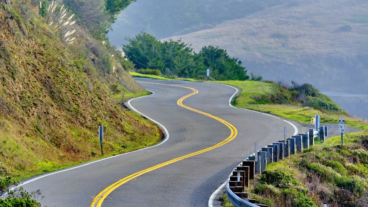
8 Mistakes Tourists Make Driving California’s Highway 1

Highway 1 through Big Sur has been closed since August 11, when a wildfire forced Caltrans to shut the road down.
There’s still no firm reopening date as of this writing.
These are the mistakes tourists make when driving on California’s Highway 1.
Note: This is general information, not legal advice. Traffic laws are subject to change, so confirm the current requirements with the California Highway Patrol.
1. Not Pulling off for Traffic
Highway 1 turns a scenic crawl into a legal problem the moment cars start stacking up behind a slow driver.
California’s vehicle code requires any driver moving slower than the traffic behind them to pull off at the next safe spot once five or more vehicles line up.
Tourists rarely know the rule exists, so they keep creeping along while a line of locals backs up behind them on a road with almost nowhere to pass.
Somebody eventually tries anyway.
That’s how a two-lane cliff road turns a slow photo run into an unsafe pass on a blind curve, with the guardrail as the only thing between the pavement and the drop.
2. Trusting the GPS Estimate
Every mile of Highway 1 breaks the assumptions a driver brings from the interstate once the road narrows into Big Sur’s curves, and a map app never adjusts for that.
AAA’s own trip planner clocks the coastal run from San Luis Obispo to Monterey at 5 hours and 29 minutes, curves included, while a driver eyeballing that same distance on a straight highway might guess something closer to two hours.
That gap catches tourists who pencil in a lunch stop in Big Sur and a dinner reservation in San Francisco the same evening.
The lunch stop gets rushed.
The dinner reservation gets canceled from the road.
Add a photo stop, a wildlife jam, or a construction delay, and the trip runs even longer than the app ever suggested.
3. Skipping the Closure Check
Highway 1 doesn’t stay open on a fixed schedule.
Tourists who assume otherwise run straight into trouble.
Caltrans first closed a ten-mile stretch of the highway near Big Sur on August 11 for crews fighting the Timber Fire.
That closure is still active.
The boundaries have since narrowed to run between mile marker 37 and mile marker 42.6, while crews scale loose rock off the cliffs above the road.
There’s no firm date to reopen it.
That’s not rare.
Storms, landslides, and wildfires have closed pieces of Highway 1 for weeks or months at different points over the past several years, and travelers get no advance notice of which stretch closes next.
The smart move is pulling up Caltrans QuickMap before you leave, not after you’re already on the road.
This closure could still be active, or another stretch could have closed, by the time you drive it.
What Caltrans QuickMap Shows for Highway 1
Caltrans tracks Highway 1 by mile marker on its QuickMap tool, not by town name, and that distinction matters because “Big Sur” can stretch across ninety miles of very different road conditions.
A marked closure means the road is fully blocked.
A one-way control or delay means the road is passable, usually behind a pilot car guiding traffic through a construction or slide site.
4. Stopping in the Traffic Lane
Tourists stop for a badge-worthy photo at nearly every curve on Highway 1, and that’s exactly the problem.
The highway builds marked turnouts along the cliffs for a reason.
Use them.
Drivers who stop in the traffic lane instead, or throw the car in reverse to catch a view they already passed, turn a minor slowdown into a hazard for everyone behind them.
Guardrails thin out or disappear completely along some of these curves, so there’s little between a stopped car and the drop below.
5. Assuming Gas Is Close
Long stretches of Highway 1 run through Big Sur with no gas station in sight, and a tourist used to seeing a gas station every few miles doesn’t expect that.
The gap catches people off guard.
Stations thin out through the coastal stretch, and the stations that do turn up charge more for the trouble of trucking fuel down a cliffside road.
Fill up early.
Top off the tank in San Luis Obispo, Monterey, or Carmel before starting the drive because the empty stretch in between offers little room to change your mind.
6. Counting on a Cell Signal
Cell coverage drops out across some of Highway 1’s most scenic stretches, right where a tourist wants to pull up a map or a reservation.
The signal just vanishes.
A route that depends on live directions or a last-minute booking can fail exactly where there’s nowhere to safely pull over and sort it out.
Download offline maps and confirm every reservation while you still have a signal.
It might not come back for miles.
7. Driving Through the Fog
Thick marine fog covers Highway 1’s cliffside curves on many mornings, especially through the summer, and that catches tourists who left home under clear skies.
Visibility can drop to almost nothing in minutes.
Many tourists running behind schedule push through the fog anyway instead of pulling over, unwilling to lose more time on a day that’s already running long.
Slow down instead.
The fog on this stretch tends to burn off by late morning, so a short wait at a pullout beats pushing through a blind curve with the ocean a few feet past the shoulder.
Coastal fog and blind curves make a difficult combination, and Highway 1 has no shortage of either.
Psst! How much do you know about Highway 1’s history and film credits? Take our quiz and see how many you can get right.
Quiz
Highway 1 IQ
Answer nine questions on the history, bridges, and film credits behind California’s Highway 1. We bet you can’t get them all right. Prove us wrong?
Who supplied most of the labor that carved Highway 1 through Big Sur in the 1920s and 1930s?
8. Planning a Night Drive
Tourists planning a Highway 1 road trip sometimes push the Big Sur stretch to the end of the day, figuring the last hour or two will go as fast after dark as it did in daylight.
It doesn't.
Street lighting on Highway 1 disappears almost entirely once you leave town limits, and long sections run with a thin guardrail or none at all.
Deer step onto the road without warning after dark.
The edge disappears too.
Tourists who press on find the same curves, drop-offs, and wildlife that felt manageable in daylight much harder to judge at night, often arriving to find gas stations and kitchens already closed for the evening.
Plan the Big Sur stretch of the trip for daylight hours, and save the after-dark miles for the straighter road on either end.
Motels and inns through Big Sur tend to book up by late afternoon in peak season, so arriving before dark also means arriving before the No Vacancy signs go up.
A same-day room is tough to find once the sun drops behind the ridgeline.
8 Things California Grocery Stores Do That Shock Visitors
A tourist wheels a full cart up to a California register expecting a free plastic bag, and there isn't one.
That's just the first surprise waiting inside a California supermarket.
8 Things California Grocery Stores Do That Shock Visitors
7 In-N-Out Mistakes That Instantly Mark You as a First-Timer in California
In-N-Out keeps six menu items off the printed board entirely, and a first-timer who never checked online just orders a plain burger.
That's one of several ways California's favorite drive-thru gives away a first-timer in seconds.
7 In-N-Out Mistakes That Instantly Mark You as a First-Timer in California
