
8 Blue Ridge Parkway Mistakes That Turn a North Carolina Leaf Drive Into a Bad Day

As of late August, the National Park Service still listed roughly 31 miles of the Blue Ridge Parkway near Linville Falls and Mount Mitchell as closed for Hurricane Helene repairs.
Full reopening in North Carolina isn’t targeted until the end of this year, and the map keeps shifting between now and then.
A map from even a few weeks ago can be wrong by the time you reach a closure it never showed.
These are the mistakes that catch North Carolina leaf drivers off guard on the parkway this fall.
1. Going on Empty
Gas pumps sit off the Blue Ridge Parkway at crossroads a few miles off the route.
On the North Carolina side, some of those crossroads run more than 30 miles apart.
Merge onto the parkway already low on fuel, chasing one more overlook before the next exit.
The needle can drop with nothing but trees and mile markers in view.
Fumes don’t cover thirty miles.
Top off before the on-ramp, in Asheville, Blowing Rock, or whichever gateway town sits closest, and treat a quarter tank as the cue to start looking for an exit sign.
2. Assuming the Whole Road’s Open
Drivers on the Blue Ridge Parkway won’t find one open, continuous line through North Carolina right now.
Those closed 31 miles come in several separate segments between Linville Falls and Mount Mitchell, with a couple of short stretches reopened in between.
A Deep Gap Bridge closure and a construction closure near Rough Ridge add two more detours to the same run of road.
Plan a route off an old map, and the parkway can hand back a barricade instead of the overlook circled on the itinerary.
Not a small detour.
Check the current status page the morning of the drive, not the week before, since conditions along this stretch change fast after storms.
3. Going Around the Barricade
The Blue Ridge Parkway’s closed stretches aren’t just inconvenient.
They’re off-limits by federal rule, and the park’s own status page states that recreation of any kind is prohibited in the Helene-damaged sections.
Rangers said in October 2024, as the closures went up, that anyone caught going around the barriers would be cited.
The pavement inside those closures can be undercut, missing, or covered by an active landslide repair, hazards a barricade doesn’t fully explain.
Slipping past a barricade for a photo risks a fine and a dangerous walk back.
Worth the wait.
Every closed section on the map has an open detour marked beside it, and that detour is the only version of the drive worth taking this fall.
4. Driving It Like a Highway
The Blue Ridge Parkway tops out at 45 mph, with tighter limits in spots.
Rangers investigate around 200 crashes a year on the parkway, and about half turn serious.
A hundred serious wrecks a year adds up.
Decreasing-radius curves tighten mid-turn instead of holding a steady arc, and the shoulders sit narrow with no white line marking the edge along much of the route.
Add a leaf-peeper braking hard for a photo two curves ahead, and a highway habit turns into a rear-end collision fast.
Fog rolls into the parkway’s higher overlooks fast on the North Carolina side, sometimes cutting visibility to a few car lengths within minutes.
Slow down before the curve, not in it.
If fog rolls in, pull into the next overlook and wait it out instead of creeping along the centerline hunting for its edge.
5. Ignoring Tunnel Clearances
The Blue Ridge Parkway runs through 26 tunnels, and the park service says most of them sit on the North Carolina side, south of Asheville.
Each tunnel carries its own clearance, and a roof box, a kayak, or a bike rack that clears the garage at home can still catch stone overhead here.
Stone doesn’t bend.
A scraped roof rack ends a leaf drive in a hurry.
The National Park Service publishes the exact height of every tunnel ahead of the season, precisely because a loaded rack doesn’t always match the numbers a driver assumes.
Check it before the trip, not at the tunnel mouth.
6. Trusting the Phone Alone
Cell service disappears across long stretches of the Blue Ridge Parkway, a condition the park’s own visitor guidance flags directly.
A phone can show bars one mile and none the next, especially where the route drops into a valley or curls around a peak.
No signal, no live reroute.
A driver relying on a phone alone for directions can keep heading toward a closure with no warning that the map stopped updating.
Download an offline map before the drive, and keep a paper one in the glovebox as a backup that never loses signal.
7. Dressing for the Wrong Elevation
The Blue Ridge Parkway climbs high enough in North Carolina to turn a warm morning into a cold one by lunch.
A National Weather Service study of the nearby Great Smoky Mountains, part of the same Southern Appalachian range, found temperatures fall about 3.3 degrees for every 1,000 feet of elevation gained.
The parkway’s highest point, Richland Balsam near milepost 431, tops out at 6,053 feet.
Serious elevation.
That’s thousands of feet above the gateway towns down in the valleys below it.
Warm enough to skip the jacket at home?
Not at 6,053 feet, with wind cutting across the overlook an hour later.
Pack a jacket, even on a warm-looking day.
The Math Behind the Parkway’s Temperature Swing
The Blue Ridge Parkway’s elevation decides how cold a stop feels, not the date on the calendar.
Climb from one of the parkway’s lower North Carolina gaps, close to 2,000 feet, up to Richland Balsam at 6,053 feet, and that’s about 4,000 feet of gain.
At roughly 3.3 degrees colder for every 1,000 feet, a 68-degree morning down low can feel closer to 55 degrees, or colder with any wind, at the top.
Wind at an exposed overlook drops the felt temperature further, so a light jacket that’s plenty at the bottom isn’t enough gear for the parkway’s high points.
8. Assuming the Lodge Is Open
The Blue Ridge Parkway’s rest stops don’t all run on the same schedule as the road.
Bluffs Lodge at Doughton Park and the Linn Cove Visitor Center are both listed closed on the North Carolina side as of late August, per the same status page that tracks the road closures.
Locked, both of them.
No warm meal, no restroom, no map at either one.
Bank on either stop for a break, a snack, or directions, and the plan runs into a locked door instead.
Check which facilities are open for the week of the drive, not just the season, since a single building can close for reasons that have nothing to do with the road.
Psst! How ready are you for a Blue Ridge Parkway leaf drive? Run through this checklist and see where you stand.
Why the Repair Map Shifts
The Blue Ridge Parkway’s Hurricane Helene recovery is still an active, moving project, not a one-time inconvenience.
The National Park Service says the worst of the damage runs from the Linville Falls area near milepost 317 south to Mount Mitchell near milepost 355, where crews were still working 45 sites as of this spring.
That recovery runs in three phases, and so far, only the first is finished.
Phase one alone restored more than 48 miles of parkway across western North Carolina by last fall.
Phase two is repairing 21 landslide areas south of Linville Falls, with the Park Service targeting a fall 2026 finish.
Phase three covers more than two dozen sites between Little Switzerland and Mount Mitchell, and it carries the late-2026 target.
The Park Service says that date still depends on contracts and construction scheduling not yet finalized.
Between Asheville and Mount Mitchell, drivers should expect dump trucks and heavy equipment sharing the open lanes, plus a 35 mph work-zone limit that replaces the parkway’s usual speed.
None of that shows up on a map printed last year.
8 North Carolina Barbecue Rules Out-of-Staters Break at Every Cookout
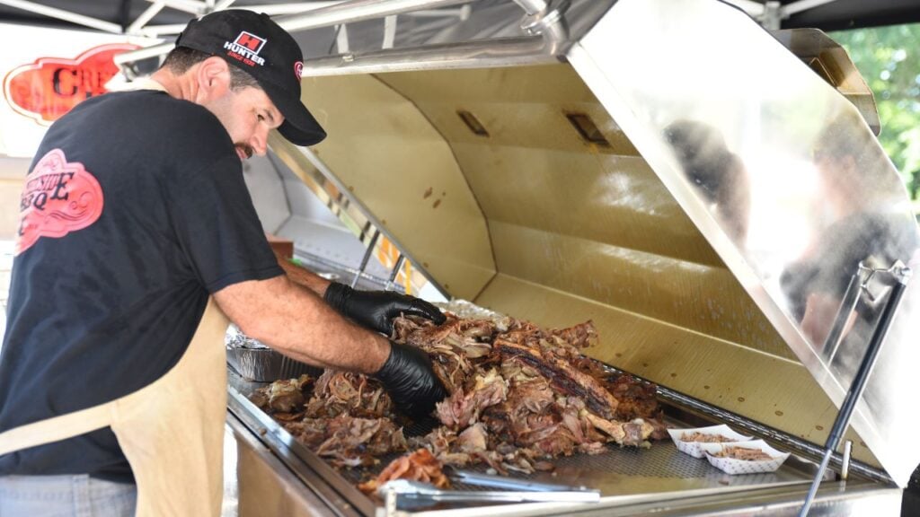
More than 100,000 people crowd Lexington every October for one plate of North Carolina barbecue, and many visitors order it wrong before they even sit down.
Vinegar or tomato, chopped or pulled, there’s a right way to ask for it at a North Carolina cookout, and out-of-staters trip over the same rules every time.
8 North Carolina Barbecue Rules Out-of-staters Break at Every Cookout
9 North Carolina Legends Residents Have Been Getting Wrong

Blackbeard died off North Carolina’s coast in 1718, and treasure hunters still haven’t found the gold everybody assumes he buried somewhere along the Outer Banks.
North Carolina keeps handing down stories like that one, and several have drifted a long way from the facts.
9 North Carolina Legends Residents Have Been Getting Wrong for Years
