
7 Arguments Ohioans Have About Whether Their City Is Midwest at All

Thirty-two of Ohio’s 88 counties carry an official Appalachian designation from the Appalachian Regional Commission.
The Census Bureau’s map counts the whole state as Midwest.
Both maps can’t be right.
These are the arguments Ohioans have about whether their city is Midwest at all.
1. Cincinnati
Cincinnati sits on the Ohio River with Kentucky visible from downtown, and that geography is the whole argument.
A University of Cincinnati linguist has traced the city’s accent to its spot on the border between the North, the South, and the Midwest.
That’s not the Inland North sound that covers much of the Great Lakes.
Cincinnati sits at the Midland’s southern edge, and its older accent even carried a vowel pattern more associated with New York City than Cleveland.
That pull runs deep.
Cincinnati was also a major landing point for Appalachian migrants chasing factory work after World War II.
By 1970, roughly 50,000 residents in the city proper identified as Appalachian.
Neighborhoods like Over-the-Rhine and Lower Price Hill still carry that history.
Add the river, the accent, and the migration together, and Cincinnati residents have a case that their city leans Upper South, whatever the state line says.
Where Ohio Falls, According to the Census Bureau
Ohio’s Midwest status traces back to one government map, the Census Bureau’s four official regions.
The Midwest region is built from two smaller divisions, East North Central and West North Central.
East North Central covers Illinois, Indiana, Michigan, Ohio, and Wisconsin.
West North Central covers Iowa, Kansas, Minnesota, Missouri, Nebraska, North Dakota, and South Dakota.
That’s 12 states, with no carve-out for a river city or a steel town.
By that map, every Ohio city named in this article, Cincinnati included, is Midwest whether it feels that way or not.
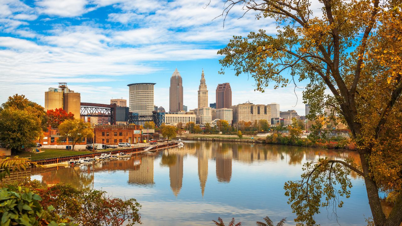
2. Cleveland
Cleveland’s claim to Midwest status runs into trouble at the root, not just around the edges.
Connecticut kept a 120-mile strip of land along Lake Erie’s south shore when it gave up its other western land claims in 1786.
Everyone called that strip the Western Reserve.
The Connecticut Land Company sent surveyor Moses Cleaveland to lay out that land in 1796.
The town his crew platted on the lake shore grew into the city that carries his name.
Reserve towns took Connecticut names like Norwalk, New London, and Litchfield.
Many still keep the town green and white-steepled church that mark a Connecticut square.
Ohioans even called the whole strip New Connecticut on early maps.
Cleveland’s accent backs up that Yankee history.
The University of Pennsylvania’s national survey of American speech places Cleveland squarely inside the Inland North, the same dialect region as Buffalo and Rochester.
The Census Bureau counts both of those New York cities as Northeast, not Midwest.
Steel mills, rail yards, and a wave of Eastern European immigrants later layered an industrial Great Lakes identity on top of that Yankee one.
That layer left behind Polish Boy sandwiches and pierogi stands instead of casseroles.
It’s not corn country.
Cleveland’s history points toward the lake and the Northeast twice over, first through Connecticut and then through the steel corridor.
Neither version points toward the cornfield towns that Midwest usually calls to mind.
3. Youngstown
Youngstown has the strangest paperwork of any city in this argument.
The Appalachian Regional Commission, a federal-state agency, officially places Mahoning County inside Appalachia, one of 32 Ohio counties on its map.
Yet the Census Bureau counts that same county as Midwest.
The maps don’t agree.
Youngstown’s Rust Belt identity backs up the Appalachian side of that argument.
On September 19, 1977, remembered locally as Black Monday, the Campbell Works steel mill shut down and cut 5,000 jobs in a single stroke.
Historians point to that collapse as one of the era’s first and starkest signs of the industrial decline the term Rust Belt would later describe.
The mills never came back the way they were.
Youngstown residents who call their city Appalachian aren’t reaching.
The government’s map agrees with them, even while a different government office insists otherwise.
4. Akron
Akron is Midwest on every federal map, no Appalachian Regional Commission exception attached to it.
Ask around the city itself, and the question gets more complicated.
Akron’s rubber factories, Goodyear, Firestone, B.F. Goodrich, and General Tire among them, recruited heavily from West Virginia and eastern Kentucky in the early 1900s.
The recruiting was so heavy that the city picked up a nickname: The capital of West Virginia.
Historians studying that migration put the number of West Virginia-born residents living in Akron by 1920 as high as 77,000 people.
That’s not a rounding error.
Those transplants organized a West Virginia Society in 1917.
By the 1930s, its annual picnic in Akron was drawing crowds as large as 15,000.
A chapter in the West Virginia University Press book Transnational West Virginia is titled “West Virginia Rubber Workers in Akron.”
No commission ever drew Akron inside Appalachia’s official lines.
Generations of Mountaineer transplants built its tire plants anyway.
The nickname they left behind never fully faded.
5. Columbus
Columbus, the Ohio capital, built its whole reputation on being exactly average.
National chains have long treated Columbus as a stand-in for the entire country.
They’ve test-launched everything from a Wendy’s burger to new Jeni’s ice cream flavors there before rolling products out nationwide.
If it plays in Columbus, the thinking goes, it plays everywhere.
That average-city reputation is exactly what the 2023 population boom put to the test.
Bank of America Institute analyzed its customer account data, not Census figures, to rank U.S. metro growth.
Columbus ranked first, adding population faster than any other metro in the country during the second half of 2023.
That ranking covers the whole metro area, several counties deep, not just the city limits.
Much of the growth is landing close enough to change Columbus.
That’s the tension.
Intel’s decision to break ground on a computer-chip campus in New Albany, just outside the city, fueled a lot of that growth.
A city built to represent everyone starts to feel like it belongs to no one place in particular.
Transplants are filling new subdivisions from every direction.
Longtime Columbus residents argue a boom that fast doesn’t feel like the predictable Midwest average-city archetype Columbus spent decades building its reputation on.
Psst! Ohio’s Midwest status has more paperwork behind it than you’d think. See what holds up.
6. Steubenville
Steubenville barely counts as Ohio to some of its residents.
Jefferson County, where Steubenville sits, is another of the 32 counties the Appalachian Regional Commission places inside Appalachia.
Steubenville sits directly on the Ohio River across from Weirton, West Virginia, close enough that the two share a single television market with Wheeling.
West Virginia is closer.
A resident can watch the local news and get West Virginia weather.
Steubenville’s steel-mill and Italian-immigrant history produced Dean Martin, among others.
That history tracks with the Ohio Valley corridor running through Pittsburgh and Wheeling more than with the flat farmland many people picture when they hear Midwest.
The river runs the argument here, not the state line.
7. Marietta
Marietta has the most ironic case of any city on this list.
Revolutionary War veterans from Massachusetts, organized as the Ohio Company of Associates, founded Marietta on April 7, 1788, as the first organized American settlement in the entire Northwest Territory.
They laid it out the way they knew back home, with a town lot and a farm lot for every family.
That New England township pattern seeded courthouse squares across the rest of the Midwest.
That’s about as Yankee an origin story as any city in this region can claim.
Yet Washington County, Marietta included, is one of the 32 counties on the Appalachian Regional Commission’s Ohio map today.
Now it’s Appalachia too.
The town that helped invent the Midwest’s New England blueprint now sits inside the federal government’s official Appalachia, and Marietta residents bring that up themselves.
Ask a Marietta local which region they belong to, and the honest answer depends on which federal map happens to be open on the table.
8 Ohio Diner Traditions That Are Slowly Disappearing

Ohio lost close to 400 restaurants, cafes, and breweries in its northeast corner alone in 2025, even as nearly 600 new places opened that same year.
Rent, thin staffing, and food costs that never eased up after the pandemic are squeezing the owners who’ve run the same counter for decades.
8 Ohio Diner Traditions That Are Slowly Disappearing
8 Ohio Fence Rules That Turn Neighbors Into Enemies

Ohio gives a misplaced fence exactly 21 years to become the legal truth, whether a neighbor ever agreed to it or not.
That’s not the only Ohio fence rule that catches homeowners off guard before a property line turns into a years-long fight.
