
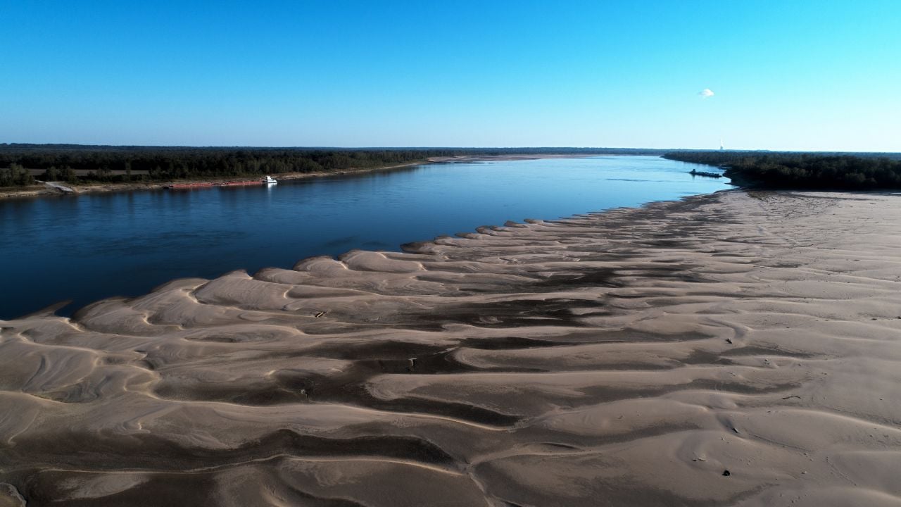
5 Rules That Decide Who Owns Mississippi Land When the River Moves

A riverbank doesn’t always stay where it was when you bought your land.
Mississippians who own waterfront property may wonder where their boundary sits after the water shifts.
Here’s how courts have sorted out who owns ground that the river changed.
Note: This is general information, not legal advice. Property laws and boundary rulings are subject to change.
1. Land the River Builds Slowly
In Mississippi, the property line follows a river that shifts slowly, according to the state’s Court of Appeals.
Lawyers call it accretion.
The rule came up in a dispute over about 17 acres beside the Bouie River in Forrest County.
A bend in the river had left a peninsula on its east side.
When the river changed course, that peninsula became an island west of the new channel.
The chancery court granted title to a landowner on the west side of the river on a theory of accretion.
A series of aerial photographs from 1942 and 1952 and a topographic map from 1965 showed the change had been gradual.
The court leaned on Mississippi Supreme Court rulings from 1943 and 1965 for the rule.
The U.S. Supreme Court described the same idea for state lines in a 1918 ruling on the Mississippi River boundary between Tennessee and Arkansas.
If your land touches a river, that same rule can change where your boundary sits.
2. The Sudden Cutoff
Around 1848, the Mississippi River suddenly left its course and cut across a bend, leaving behind a tract of land known as Horseshoe Island.
In 1919, the Court ruled that the line stays in the middle of the old channel as it ran just before the shift.
The legal word is avulsion.
Mississippi’s Supreme Court has said a sudden river change may leave land title, mineral rights, and even state sovereignty where they were.
If the river moves away from your land overnight, your property line generally stays where it was.
How Mississippi’s Courts Tell Slow From Sudden
Mississippi’s Court of Appeals judges a river change by what a witness could see while it happened.
If a witness couldn’t perceive the change as it went on, that’s accretion.
If the change was distinctly perceptible or measurably visible while it was happening, that’s avulsion.
A witness can see that progress was made from time to time, and the change still counts as accretion.
3. The Accretion Burden
When two states fight over new land in the river, the state claiming a sudden shift carries a considerable burden.
Luna Bar sits in the old bed of the Mississippi River, and the U.S. Supreme Court’s 1974 decree says it belongs to Mississippi.
The bar sits where Mississippi’s Washington County and Arkansas’s Chicot County adjoin.
The ruling turned on one question: whether the bar formed slowly by accretion, which favored Mississippi, or by a sudden avulsion, which favored Arkansas.
Arkansas never overcame Mississippi’s opening case.
Arkansas didn’t meet it.
You might expect a map to settle who owns an island, but this fight turned on trees and soil.
Mississippi presented forestry evidence that no tree on the bar was more than 37 years old.
The Court credited evidence that stumps on the bar had washed in on floodwaters, not grown in place.
If you were Arkansas, you’d have had to prove the river jumped in one sudden shift.
Psst! How much do you know about river land rules? Flip these cards and see if you can spot every myth.
4. The Channel Line
On the Mississippi River, the 1919 ruling said the line between Mississippi and Arkansas runs down the middle of the main navigable channel.
Courts call a line like that the thalweg.
In 1984, the Court applied what it called the live thalweg, a line that follows the channel as slow erosion and accretion reshape it.
That case started with a well a lessee drilled at an angle under the river from land on the Mississippi side.
The stakes were underground.
Louisiana and Mississippi disagreed about which state the bottom of that well sat in.
The bottom hole had been in Louisiana ever since the well’s completion in 1972.
If you stand on the Mississippi bank, the state line in front of you runs through the channel, and your shoreline isn’t it.
5. River-Made Lakes
A lake the Mississippi River scours out of farmland doesn’t erase who owns the ground beneath it.
On April 17, 1912, a levee broke in western Bolivar County, and the river scoured out the lake known as the Merigold Blue Hole, about 92 acres of water.
In 1990, the Mississippi Supreme Court ruled that the landowners who held record title to the lake bottom still owned it.
The fishermen in that case still lost.
Record owners of navigable waters can’t exclude the public from the surface.
But the court found this crevasse wasn’t navigable until a 1929 Corps of Engineers dredging project, so the landowners won.
So the general rule and the result in that case point different ways.
If you fish a navigable Mississippi lake, the owner of the bottom can’t keep you off the surface.
A 2011 University of Mississippi legal paper says oxbow lakes form when a sudden cutoff separates a river bend from the main channel.
Mississippi’s attorney general called oxbow lakes with currents that reverse as the Mississippi River rises and falls navigable waters in 1993.
Mississippi Land Across the River
Davis Island sits on the Louisiana side of the Mississippi River, yet the Vicksburg Post reported in 2016 that most of it belongs to Mississippi.
A cutoff in 1867 turned a peninsula there into an island.
The island once held Hurricane Plantation, owned by Joseph Davis, next to Jefferson Davis’s Brierfield.
Warren County deputies reach the island by patrol boat or by crossing the bridge into Louisiana and driving south to a private ferry.
Psst! How much do you know about the Mississippi River? Take our quiz and see if you can ace it.
Quiz
Mississippi River IQ
Answer nine questions on Mississippi’s rivers, floods, and history. We bet you can’t get them all right. Prove us wrong?
How much land did the water from the 1927 Mound Landing levee break in lower Bolivar County cover, ten feet deep, in ten days?
Finding the Channel
If you picture the Mississippi River's channel as a clear ribbon of deep water, your picture won't match the stretch the Supreme Court studied in 1984.
In that four-mile reach upstream from Natchez, an uninterrupted trough of deep water never has been present.
A trough of deep water generally lay along the Louisiana bank upstream of the bend and another along the Mississippi bank downstream of it.
Depth alone couldn't settle it.
So the Court asked where boats ordinarily travel.
It weighed hydrographic surveys, which record water depths and contour lines.
Coast Guard channel reports, which recommended a course by reference to lights and buoys, counted too.
The surveys also noted the location of lights the Coast Guard placed as an aid to navigation.
6 Mississippi Myths Locals Are Tired of Correcting

Out-of-staters get a lot about Mississippi wrong, and the locals have heard every version.
Start with the Delta, and you'll see why they sigh.
6 Mississippi Myths Locals Are Tired of Correcting
5 Heir Property Rules That Cost Mississippi Families Their Land

Mississippi families don't need a bad decision, a bankruptcy, or a lost court case to lose land they've held for generations.
One skipped step is all it takes.
5 Heir Property Rules That Cost Mississippi Families Their Land
