
5 Utah Rock Formations Utahns Are Tired of Explaining

A tourist at a Bryce Canyon overlook points down at the orange spires and asks the Utahn next to her if park crews built them.
Nobody built anything.
These are the Utah rock formations Utahns are tired of explaining.
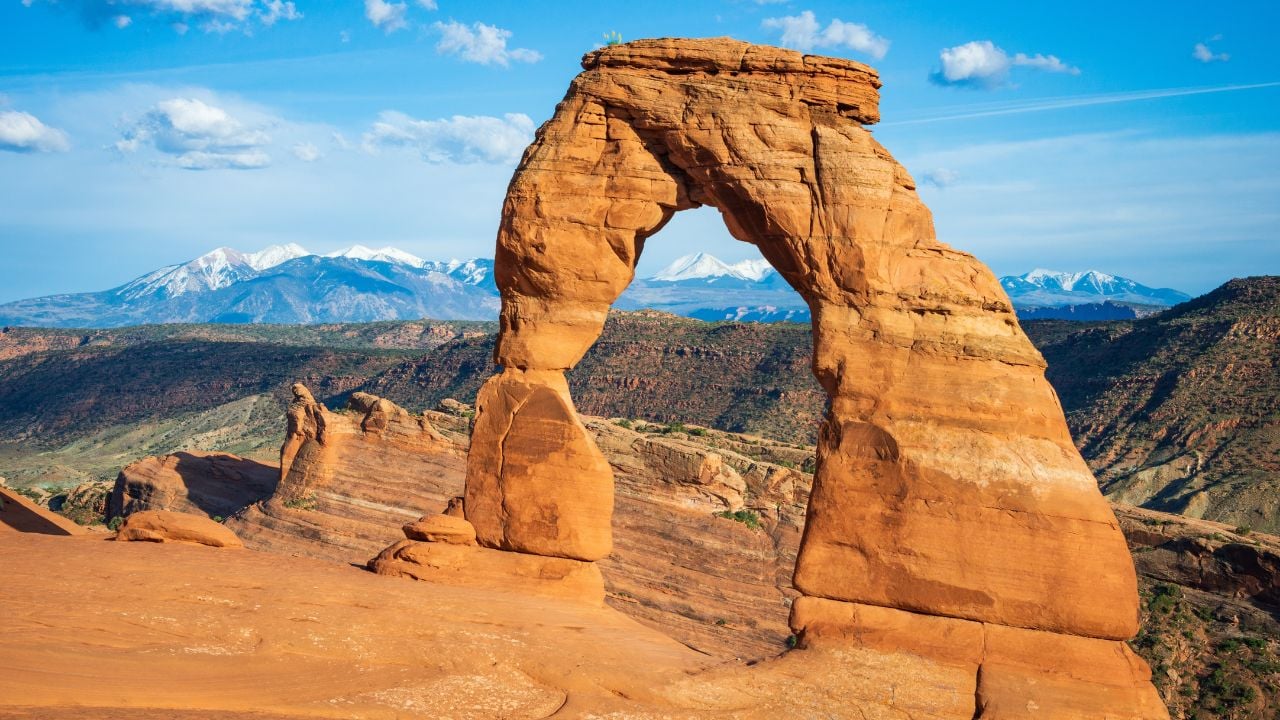
1. Delicate Arch
Delicate Arch first appeared on a Utah license plate in 1992, and today it’s pictured on the free “Life Elevated Arches” plate.
The rental company Sixt ranked that plate the second-best-selling state specialty design in the country, with more than 1.1 million sold to Utah drivers.
Out-of-staters see that shape and assume they can pull off the highway for the same photo.
They can’t.
Arches National Park dropped its timed-entry requirement this year, so anyone can drive through the gate whenever it’s open.
That pass only gets a visitor into the park, not up to the arch.
Reaching Delicate Arch means a 3-mile round trip with roughly 480 feet of climbing, much of it up open slickrock with no shade and no water.
The final stretch narrows onto a rock ledge for about 200 yards before the arch comes into view.
Out-of-staters ask, at least once a summer, if there’s a shortcut.
None exists.
Wolfe Ranch, the trailhead lot, fills up early on summer mornings.
2. Bryce Canyon’s Hoodoos
Bryce Canyon’s hoodoos make visitors assume they’re standing inside an actual canyon, carved the way the Grand Canyon was carved by a river.
They aren’t.
No permanent river ever ran through Bryce Canyon National Park, so what looks like a canyon is technically a string of amphitheaters cut into the edge of a plateau.
Ice did the rest.
Water seeps into the fine cracks in the park’s limestone, freezes overnight, expands, and pries the rock apart bit by bit, a process called frost wedging.
Visitors ask at almost every overlook how these things got their shape.
“Ice” is rarely the answer anyone expects.
The Number Behind Bryce Canyon’s Ice
Bryce Canyon’s frost-wedging explanation for its hoodoos rests on how many days a year the temperature swings across freezing.
The park logged about 170 of those freeze-thaw days in 2020, down from 220 in the 1960s, a measurable 50-day drop in sixty years.
Every popular explanation for how the hoodoos form traces back to one 1980 dissertation out of the University of Utah.
The National Park Service says nobody has ever peer-reviewed it or replaced it with something new.
3. Goblin Valley’s Goblins
Goblin Valley’s goblins are sandstone hoodoos scattered by the thousands across the valley floor.
Many out-of-staters assume the 2013 vandalism scandal here ended all the climbing.
Utahns know that scandal changed very little.
That year, Glenn Taylor toppled one of the hoodoos on video and pleaded guilty to criminal mischief.
David Hall, who was with him that day, pleaded guilty to the lesser charge of attempted criminal mischief.
Utah lawmakers responded by pushing for tougher penalties on anyone who damages state park land.
Goblin Valley’s brochure still lets visitors walk among the goblins and climb the sturdier hoodoos.
It only bans mutilating, defacing, or toppling a hoodoo.
Beyond that, it just asks people to stay off the more fragile formations.
A day pass runs $20 per vehicle, and that’s the only requirement.
Utahns spend more time explaining what’s still legal here than what isn’t.
4. Mexican Hat
Mexican Hat is a sombrero-shaped slab of Cedar Mesa sandstone, 60 feet wide and 12 feet thick.
It balances on a red shale pedestal beside the tiny town that borrowed its name.
Out-of-staters hear “Mexican Hat” and assume it marks some kind of border landmark.
It’s nowhere near Mexico.
The formation sits in San Juan County, in Utah’s southeastern corner, about 100 miles south of Moab and hundreds of miles from the nearest Mexican border crossing.
That name only ever described the rock’s shape, a caprock some early traveler thought looked like an upside-down sombrero.
Rock climbers have been summiting the caprock since at least 1962, when the first recorded ascent went up its overhanging top.
Anyone can pull off U.S. Highway 163 for a free look at Mexican Hat, no ticket booth required.
Climbing to the top is legal, since the rock sits on land the Bureau of Land Management manages.
Reaching it means crossing private property first.
Since spring 2022, the landowners have posted a sign charging visitors a fee to cross their land for camping or climbing access.
Ask a Utahn who lives near the turnoff, and the fee comes up before the sombrero shape does.
5. Kolob Arch
Kolob Arch is one of the largest free-standing arches in the country, tucked deep inside Zion’s wilderness.
Out-of-staters expect a pullout and a short walk, the way Delicate Arch’s picture makes arches look easy.
The arch doesn’t work that way.
Reaching Kolob Arch means a 14-mile round trip on the La Verkin Creek Trail from the Lee Pass trailhead, with no shortcuts and no shuttle.
A day hike needs no permit at all.
Camping overnight along the way does need one.
Zion issues that permit for only one of 13 designated campsites, and hikers pick it up in person at a visitor center.
Visitors ask constantly why a national park would gatekeep one of its biggest attractions.
It’s not gatekeeping.
The permit rule keeps thirteen backcountry campsites from taking on more hikers than the trail can hold.
Psst! How much do you know about Utah’s strangest rocks? Take our quiz and see how many you can get right.
Quiz
Utah Rock IQ
Answer these questions on Utah’s strangest rocks. We bet you can’t get them all right. Prove us wrong?
Cowboys and newspaper editors nicknamed today’s Delicate Arch something else before 1934. What did they call it?
Everybody Thinks This Is Utah
The Wave is a swirl of striped sandstone about 46 miles from Kanab.
Many people treat it like a Utah landmark without ever applying for a permit to see it.
It's Arizona's, not Utah's.
The formation sits inside Vermilion Cliffs National Monument, which the Bureau of Land Management places in Arizona, not Utah.
Kanab just happens to be the closest town, so it ended up hosting the tour outfitters and permit information for a formation across the state line.
Getting a permit today means winning one of two Recreation.gov lotteries, since Kanab's old walk-in lottery closed in 2022.
The daily drawing takes applications from 6 a.m. to 6 p.m. Utah time, two days before the hike, for a nine-dollar fee.
That fee doesn't come back if a name isn't picked.
Utahns still field the questions anyway, since Kanab is where many people start planning the trip.
9 Things South Carolinians Assume Every American Grew Up Doing

A kid growing up in South Carolina learns early that the giant flying bug in the carport is always a palmetto bug, never a cockroach.
Say that word anywhere outside the South, and many people just stare back blankly.
9 Things South Carolinians Assume Every American Grew Up Doing
