
9 Things Texas Storm Chasers Notice Long Before a Warning

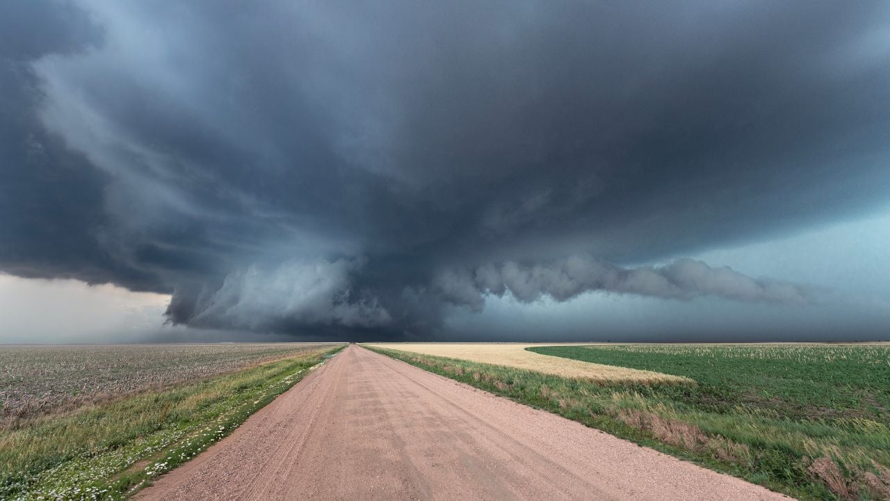
A storm chaser parked along a Texas Panhandle farm road can watch cumulus towers rise and collapse, again and again.
Then a tower holds.
Hours later, that kind of storm can produce a tornado strong enough for an EF3 rating from the National Weather Service. A tornado picked up that same rating in Perryton, Texas, on June 15, 2023.
These are the things storm chasers notice long before a warning.
1. Mesoscale Discussion
Storm chasers start checking the Storm Prediction Center’s site once conditions start shaping up for severe weather.
The center calls that bulletin a mesoscale discussion, or MD, and per the National Weather Service’s glossary, it typically goes out 30 minutes to several hours ahead of a watch.
It’s not a watch upgraded to a warning.
It lands before the watch does.
Chasers read an MD for the reasoning behind it: The timing window, the county line in play, and the ingredient a forecaster fears losing before anything else.
That head start matters.
Watch vs. Warning, in Plain Terms
A tornado watch means the Storm Prediction Center thinks a broad stretch of Texas can support tornadoes sometime over the next several hours.
A tornado warning means one is happening right now, or radar and spotters show one is close, in one county or two.
Storm chasers treat the watch as the invitation and the warning as the moment they’re already supposed to be in place.
2. Lightning Jump
Chasers pay attention when a storm’s lightning suddenly speeds up.
A sudden spike in a storm’s overall lightning activity is what the National Severe Storms Laboratory (NSSL), a National Oceanic and Atmospheric Administration (NOAA) lab, calls a lightning jump.
NSSL’s research has found rapid increases in a storm’s lightning often show up tens of minutes before severe weather, tornadoes included, reaches the ground.
That’s a head start.
A storm chaser doesn’t need research-grade equipment to catch it, just a sense of how fast the strikes are coming.
A lightning jump can build long before a couplet ever shows up on radar, let alone a warning goes out.
3. Turkey Towers Over the Dryline
A storm chaser’s afternoon often starts with counting cloud towers along the dryline.
A turkey tower is a single cumulus tower that shoots straight up and falls apart within minutes.
Many towers lose.
Each failed tower is the atmosphere testing a cap, a warm layer holding storms down, at that exact spot.
Once one tower finally survives, the cap has broken there and nowhere else yet.
Chasers who’ve watched a hundred towers rise and die know the difference, often minutes before a radar echo shows up at all.
4. Beaver’s Tail
Storm chasers watch for a long, flat cloud feeding straight into a storm’s updraft.
The National Weather Service’s spotter glossary calls it a beaver’s tail, an inflow band shaped like the animal’s namesake.
It runs alongside the storm’s pseudo-warm front and feeds moist air straight into the updraft.
A short, ragged tail means the storm is still figuring itself out.
A long, smooth tail feeding hard into the base is different.
That storm is organizing.
Chasers clock the tail’s length and speed long before any rotation shows up on a radar screen.
5. Striated Banding
Chasers look for a storm’s base to start taking on a striped, stacked-plate look.
Striated banding is the term for parallel bands wrapping the lower part of a rotating updraft.
The National Weather Service’s spotter glossary lists striations among the visual signs that a mesocyclone, the storm’s spinning core, is organizing.
The bands stay smooth and distinct.
The pattern matters.
Clean, distinct striations mean the rotation has structure, not just a messy spinning blob of cloud.
That structure is usually what earns a warning a little later on.
Psst! How storm-ready is your Texas household? Run through this checklist and see where you stand.
6. Dashboard Numbers
Many storm chasers keep a handheld weather meter within reach, checking it almost as often as the windshield.
A weather meter built for storm chasing tracks temperature, humidity, and dewpoint in real time as the vehicle moves.
Chasers watch the dewpoint reading to tell whether they’ve driven into richer moisture, the fuel a storm needs to keep building.
That’s more fuel.
A falling reading means the opposite: Drier air works against the storm instead of feeding it.
Chasers who watch that reading can clock a storm’s best fuel corridor before it ever shows up as a shape in the clouds.
7. Velocity Couplet
Texas storm chasers running an app like RadarScope watch the same raw radar data a Weather Service forecaster watches.
A velocity couplet is what rotation looks like on Doppler radar, a tight patch of wind racing toward the radar sitting right beside wind racing away from it.
That’s the tell.
The National Oceanic and Atmospheric Administration’s radar researchers have tracked a related signature, called azimuthal shear, showing up a few minutes before a full couplet even forms.
That’s an early word, before the couplet ever prints.
Raw radar data reaches a chaser’s phone within moments of reaching the forecaster’s screen.
A chaser watching that early signature can start repositioning during the same minutes a forecaster still spends confirming it and drafting the warning, instead of waiting on the finished alert.
8. Clear Slot
A storm chaser standing on the caprock, miles from the nearest radar in Amarillo or Lubbock, can sometimes see a tornado forming before that distant radar ever could.
That’s just geometry.
A radar beam travels in a straight line while the Earth curves away underneath it.
At long range, the dish ends up sampling a storm well above ground level, missing whatever’s happening down at the surface.
A clear slot is the horseshoe-shaped notch that opens in the back of a wall cloud as the rear flank downdraft wraps around it.
The National Weather Service’s spotter guide puts its lead time at 5 to 10 minutes before a tornado forms, if one forms at all.
Out on the Panhandle, that gap can matter more than it does anywhere with a radar close by.
9. Ground Dust Whirl
Storm chasers treat a ground dust whirl as more than a strong gust passing through.
The National Weather Service’s tornado life-cycle guide lists a dust whirl with no funnel connected yet as the first sign a tornado may be forming.
The dust moves first.
Rotation is already building at ground level before any cloud ever reaches down to meet it.
That’s the same National Weather Service office that rated the tornado through Perryton, Texas, an EF3 after it tracked the town on June 15, 2023.
A chaser who radios in a dust whirl isn’t just offering color commentary.
A confirmed spotter report is what upgrades a warning from “radar-indicated” to “confirmed,” and that call can go out before radar alone would ever trigger one.
A forecaster miles away is trusting that same call, sometimes before radar alone would have shown a thing.
7 Kids-Eat-Free Deals That Fall Apart at the Register in Texas

A Texas family sits down at the table doing quick math on a “kids eat free” sign, and the total still comes out wrong.
Nothing on the sign is false. It just leaves out the part that decides whether a kid’s plate is free tonight.
7 Kids-Eat-Free Deals That Fall Apart at the Register in Texas
6 Perks Texas Lawmakers Collect That Their $7,200 Salary Doesn’t Show

Texas voters fixed state lawmakers’ pay at $7,200 a year back in 1975, and the number hasn’t budged since.
As with a lot of things in government, that number doesn’t show the full picture.
6 Perks Texas Lawmakers Collect That Their $7,200 Salary Doesn’t Show
